Dodman Point boasts of being the highest headland on the South coast of Cornwall. Hiking in from the beautiful fishing village of
Gorran Haven we were perhaps distracted of the ascent by numerous wildlife encounters along the way? However, on the return journey along the coastal path it became clear that we were walking downhill most of the way home!
Our day's adventure started with the obligatory and very tasty Full English Breakfast at the
Llawnroc Hotel. [As an aside the hotel's main restaurant has a flat "green roof " with a "wildflower turf " on it - this turf was in flwr at the time of our visit and a plethora of orchids - predominantly green-winged orchid (
Anacamptis morio) made for an eye-catching effect. It took every fibre of good-will, for me not to climb out of our bedroom window - which immediately overlooked it - to get closer to the box of delights].
After breakfast we took a quick shifty around
St Just Church which holds tightly onto the cliff top above the harbour beach.
 |
| St Just, Gorran Haven |
 |
| St Just above the harbour beach, Gorran Haven |
The walk to Dodman Point took us past Vault Beach. We had planned to go rock-pooling at Vault Beach at low tide later that afternoon, but we ran out of both time and energy in the warmth of the day. Instead we retired early to Cakebreads Bakery a One-Stop-Shop which includes the local Post Office / Grocery Store and Beach Bar!
Cakebreads Bakery also helped to fuel our exploration of
The Roseland Peninsula in its daily provision of fresh Cornish Pasties.
However, the aspirational rock-pooling does go someway to explain the seemingly random child's fishing net, hanging out of the back of my rucksack like a cheap mockery of some Japanese Samurai's foot-soldier's flag.
 |
| towards Vault Beach |
 |
サムライと旗
|
Random wildlife on the coastal path:
 |
| Macrothylacia rubi |
 |
| Cornish hedge |
 |
| Umbilicus rupestris |
 |
| Anguis fragilis |
The most striking feature of Dodman Point is the large Iron Age earthwork which separates the headland from the mainland of Roseland St Just. Some 666m long and 6m high - the earthwork can be walked along it's entire length following the footpath that runs between it and an adjacent hedge on the northern boundary.
 |
Iron Age Earthwork, Dodman Point
- travelling West to East |
The passage of the footpath was filled with wildflowers and was consequently brimming with invertebrates - incl. numerous butterflies - and a handful of broad-bodied chasers (
Libellula depressa).
 |
| Libellula depressa |
The headland also features the archaeological remains of Bronze Age barrows (not seen on the day) and medieval field systems. An 18th Century Admiralty signal station (the Watch House) also stands on the Point - acting as a look out for Plymouth Harbour during the Napoleonic times.
 |
| Medieval field system (Rems.) |

 |
| Watch House |
 |
| Watch House detail |
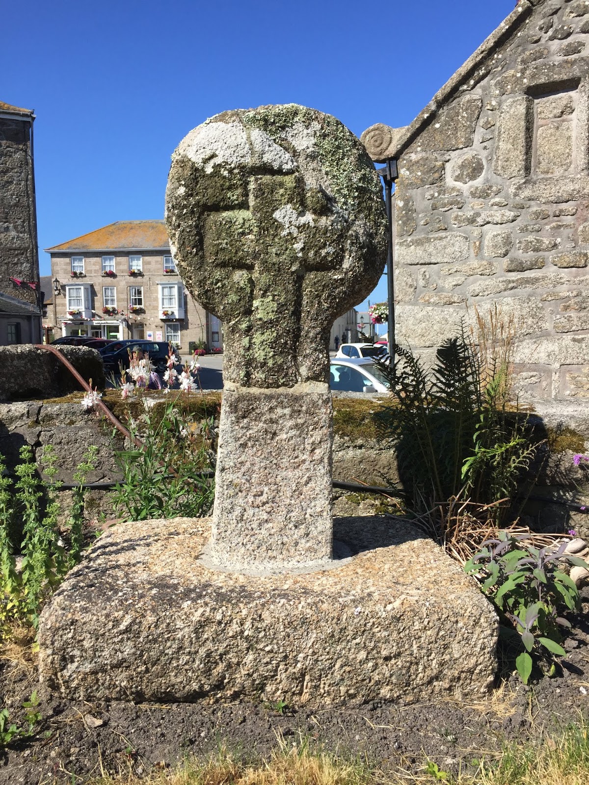
On the western tip of the Point an imposing 19th Century Granite Cross - also stands looking out to sea. The cross being erected in 1896 by the Rev George Martin of Caerhayes as a shipping navigation aid - in response to the collision two naval destroyers which had occurred near the point earlier in that year (The South West Coast Path 2018 ONLINE).