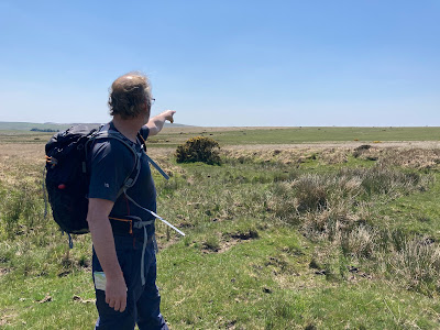
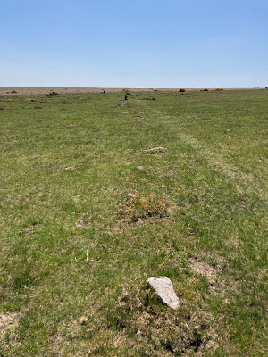
The stone complex as recorded on the OS map reads “Cairn Circles” (OS Explorer OL28). However, the description is of a fourfold stone circle (four concentric stone circles) in "The Field Archaeology of Dartmoor" belonging to the Early Bronze Age (Newman, P. 2011).
The circles do surround a central cairn (Historic England 2023) although this was not obvious, and I had to intuitively sense its placement rather than see it in situ. Any raised ground indicating the presence of a central cairn being slight enough to suggest natural topography.
 |
| four concentric stone circles |
 |
| central stone circle surrounding a cairn |
To the immediate southwest the remains of a double stone row are visible. This site reminded us in part of Shovel Down, which also boasts a double stone row terminating at a four concentric stone circles. Whilst the latter fourfold circle is just half the diameter of Yellowmead (Thurlow, G. 2001) the combined stone settings at Shovel Down is landscape scale compared to the remains at Yellowmead.
William Lethbridge (2015) indicates that the Yellowmead Circles, differs today from the earliest description of the site made by R. H. Worth of the Dartmoor Exploration Committee [DEC]. The committee surveyed and produced literature between 1893 - 1906 (DartmoorCam 2023). In the DEC report the circles comprised of 104 stones – now 106; and with six stone placements at right angles to the circles which have since disappeared, along with two of the stones of the double stone row (Thurlow, G. 2001).
 |
| double stone row detail |
Leaving Yellowmead behind us, we headed south, and explored the numerous cairns at the base of Gutter Tor, looking for, but failing to find the Cist.
 |
| one of several cairns at the base of Gutter Tor |
 |
| Gutter Tor |
Ascending Gutter Tor I found the natural rock basins in the summit rocks.
 |
| natural rock basins, Gutter Tor |
After lunch, we set a compass bearing for the remains of a farmstead on Ringmoor Down.
 |
| "that looks like a standing stone over there .. .. although it could just turn out to be a cattle rubbing post?" |
Crossing Legis Mire we found it was not as wet under foot as anticipated. The standing stone turned out to be in the northern end of the sought-after stone row alignment, and we followed the row south and uphill to the cairn circle which was set at its terminus. As we ascended the stone row in places became a double stone row (Lethbridge, W. D. 2015).
 |
| heading south (and uphill) along the stone row |
 |
| Evidence that it may have originally been a double stone row? after Lethbridge (2015) |
 |
| And on to the terminal cairn |
Newman (2011) indicates that although there is a lack of precision in dating the stone rows of Dartmoor, it is most probable that they belong to the late Neolithic / early Bronze Age periods. Particularly with respect to those rows, such as at Brisworthy which are strongly associated with cairns, and often with burial remains. See also below for the stone complex at Merrivale (Blogs passim).
At this point, in our walk, we had to concede that we had both come out ill-prepared for the dry heat and clear sunny skies that the day provided. We had forgotten to bring sunblock, underestimated our water requirements, and along with the prolonged exposure on the open moor, we were starting to feel overheated and sunburnt. As such we decided to head back north, rather than extend the walk south to the Brisworthy Stone Circle, but not before we had located the bijou stone circle to the southwest. Lethbridge (2015) suggests that this small circle has had several stones added in more recent times.
Our return journey took longer than we had hoped given how hot and tired we both were by mid-afternoon. The higher moor to the east of Yellowmead Farm’s field boundaries was heavily waterlogged and we could not find and refollow the outward route. After a significant detour, we reached the Farm at 15:30 PM. Over our day’s walk we had covered 10.5KM but with the exposure on the moor it had felt a lot further!
Accommodation
The Meeting House, Yellowmead Farm
Bibilography
DartmoorCAM (2023) [Online] Dartmoor Expedition Committee
https://www.dartmoorcam.co.uk/CAM/DartmoorExplorationCommittee/DEC.htm Accessed 29th October 2023
Historic England (2023) [Online] Yellowmead stone circles, cairn and stone alignment
Historic England (2023) [Online] Yellowmead stone circles, cairn and stone alignment
https://historicengland.org.uk/listing/the-list/list-entry/1010212?section=official-list-entry Accessed 29th October 2023
Lethbridge, W.D. (2015) Discover Prehistoric Dartmoor, A Walkers Guide to the Moorland's Ancient Monuments Halsgrove, Somerset
Newman, P. (2011) The Field Archaeology of Dartmoor English Heritage Swindon
Lethbridge, W.D. (2015) Discover Prehistoric Dartmoor, A Walkers Guide to the Moorland's Ancient Monuments Halsgrove, Somerset
Newman, P. (2011) The Field Archaeology of Dartmoor English Heritage Swindon
Ordnance Survey Dartmoor Showing part of the National Park Map OS Explorer OL28 1:25,000 scale
Thurlow, G. (2001) Revised Edition Thurlow's Dartmoor Companion Peninsula Press, Newton Abbott, Devon
Thurlow, G. (2001) Revised Edition Thurlow's Dartmoor Companion Peninsula Press, Newton Abbott, Devon


No comments:
Post a Comment