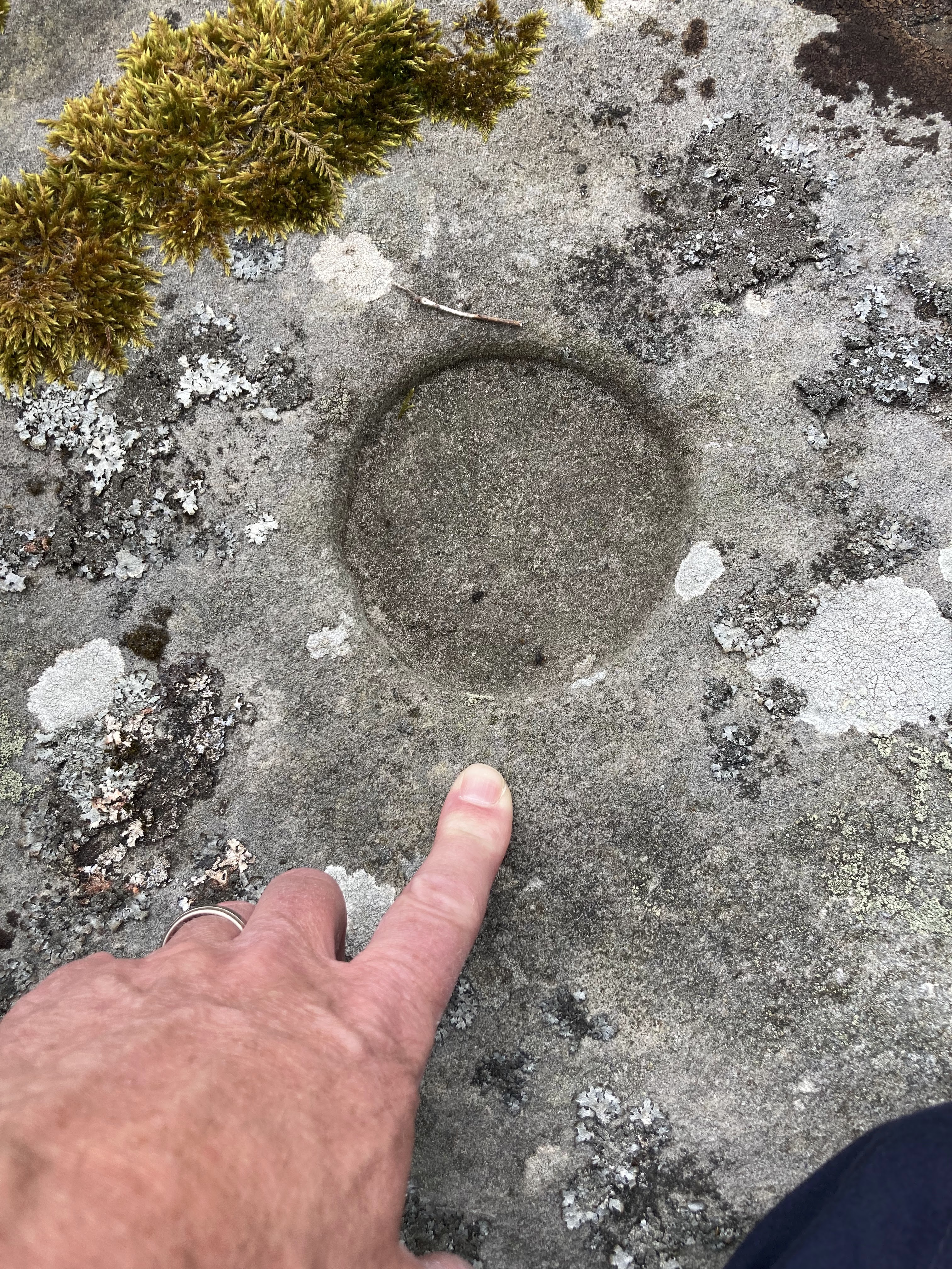
After a brisk walk from Wooler, up to and across the top of Weetwood Moor to meet the Bridleway in the North-East corner, we were disappointed to find the Public Right of Way had been re-routed Ca. 100m south of its original route. This means that the extended line of cup and ring marked stones in that corner, is effectively cut off from public access.
heading north on top of Weetwood Moor
heading East atop the Moor
As we headed back towards the single stone in the South West corner of the moor, we could see the probable line of flat rocks, which contained the bulk of the visible archaeology - now frustratingly out of reach.
the PRoW re-direction notice
the closed section of moor behind the fence-line
Whilst the single cup and ringed mark rock, was relatively easy to find, being situated on top of a low rise, near the antenna enclosure. We were initially bemused to find that when walking to the "exact location" as indicated on the OS App, it left us staring at a large slab of flat rock which did not appear to have any markings on it at all? We decided to walk in increasing circles from this rock, and soon found another slab, this time with a noticeable ring mark some 10ms or so East of the first.
Housesteads Roman Fort is an impressive ruin .. but what captured our imagination the most was the sight of Hadrian's Wall stretching East and West into the distance. "A" and I are now planning to walk the long-distance trail!
.. for those of you that love a Trig Point (you know who you are) ..
T-Shirt by Hare and Tabor
We could have easily overlooked these cup and ring marked stones, as they are not marked on the OS Map. Initially we had headed off onto the north eastern part of the high moor, chasing every stone that peaked above the heather, and for no reward.
Frustrated, I resorted to Google, and found a fellow Blogger who was generous enough to give detailed instructions to the archaeological features. The stones can be found "in the rough" of the Golf Course just to the north of the Shepherd's Cottage.
However, on the day, our stones were found outside the perimeter fence of the Golf Course, between the fence and Iron Age settlement; between the fence and the Shepherd's Cottage. Phew!
In searching the rocky outcrops immediately behind the Shepherd's Cottage we also found a set of modern rock carvings.
Disappointingly, access to the gully to view the waterfall from below was entriely restricted, desire lines had been successfully closed using a combination of brash piles, and felled trees. The public are more than convincingly "not welcome". Working as we both do in the Countryside Sector, we dutifully obeyed the restrictions - and viewed the torrent from above, only. As you can see from the video, this is a somewhat underwhelming vista.
On our second visit to Lindisfarne we have booked into the Lindisfarne Hotel for a couple of nights, affording us two half days and a full day on the island to explore.
Our exploration has been enhanced by the purchase of "Holy Island, Isle of Winds, An Intimate Guide" (Bevan, J. 2018 2nd Edition). A publication that came highly recommended by Sean, the manager/owner of the Hotel. The book can be purchased from the Post Office or the Lindisfarne Heritage Centre.
Lindisfarne Heritage Centre
rems. of Priory from the Heugh
Having explored the Priory ruins previously, on our first visit to the island, we were content with an overview of the site from the Heugh.