Showing posts with label double stone row. Show all posts

Thursday, 6 August 2020

Cairns, cists and stone rows .. Bellevor Tor environs .. Dartmoor pt 3

On the wettest day of our trip, we caught up with A & Z for a socially distanced exploration of the monuments of Lakehead Hill & Bellevor Tor.

Cairn and cist detail

Cairn detail

Stone row

This cairn, cist and stone row setting was simply beautiful, even more so for its unexpected "reveal", appearing within a small glade as you walked down a short forest track. I found it difficult to leave and took too many photographs, instead of simply spending time within it. A new site for a future pilgrimage.

In complete contrast the next cairn we viewed was with the most unwelcoming of monuments I have ever encountered. In response to my usual silent greeting to ancestors and request for permission to enter the circle of kerb stones - I felt the strangest of pressures on my chest - pushing against me to move away from the site. This sensation was new to me, and I heeded the discomfort and did not enter.

An unwelcoming cairn
Not wishing to spend anymore time with the unwelcoming cairn, I headed off quickly to track down a solitary cist, its cairn lost long ago below the woodland edge. Then on to Kraps Ring settlement - whose scale defied any meaningful photography - having walked the perimeter - we settled for lunch on the stones of a presumed hut circle.

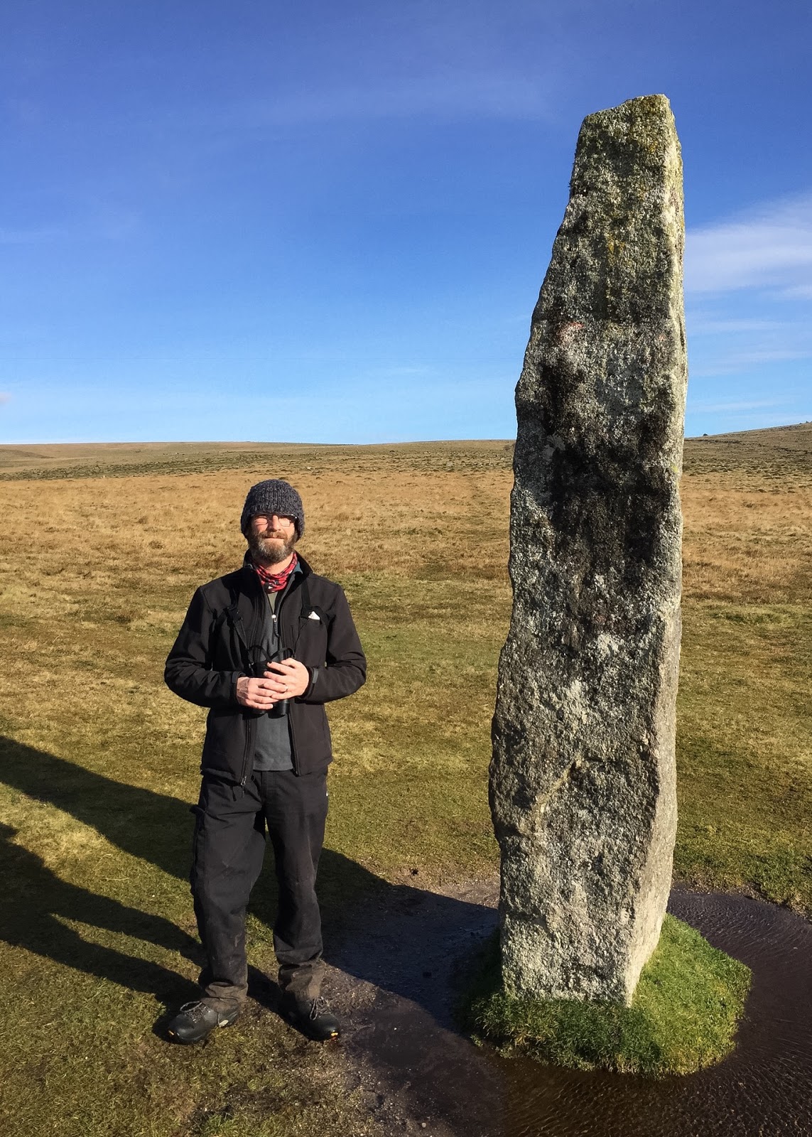
Heading South we passed beneath the mist clad Bellevor Tor, and beyond to Laughter Tor. From the the summit of Laughter Tor - we picked up the line to follow to get to the single standing stone positioned at the upper end of a double stone row. The stone rows ran approx south-south-east before ending abruptly at a more modern field boundary. A little below the field boundary we found a second double stone row, which appeared to follow the first on the same bearing, and thus possibly belonged to the same monument?


Standing stone (looking South)

Double stone row - looking South towards field boundary
Double stone row - looking north towards
field boundary and standing stone beyond

Sunday, 19 May 2019

.. stoned ag'in in Exmoor .. pt 1

We first visited Exmoor in 2012. The Queen's Diamond Jubilee celebrations were in full swing - and we were hoping to avoid the whole shebang - so we headed for somewhere to put us out of the way of the festivities. Rocking up at a cracking little campsite at Halse Farm, which sits just below the moor line on Winsford Hill, Exmoor.

Halse Farm Caravan and Camping Site

On our first walk out from the campsite we witnessed the strangest of sights - a small bristling tree line moving itself along the horizon of a nearby hill - probably Withypool Hill (?). I remember watching in complete astonishment - as the wood headed up towards the top of the hill. Finally a tractor emerged from beneath it, and a trailer. Back at the campsite I remarked upon the scene to the Farmer - and she replied enigmatically:

"I look'd toward Birnam, and anon, methought, The wood began to move".

The coming Monday was the night of the Jubilee beacons. Winsford Hill had its own beacon. So early on the evening of the 4th June, whilst we sat outside the tent drinking a local rough scrumpy; the campsite emptied - campers and villagers alike were heading upwards to the celebrations. It dawned on us - that we would be missing "An Historical Event of Landscape Scale". So we followed the crowd and were not to be disappointed.

Winsford Hill Beacon 4th June 2012

As the Winsford Hill beacon flared .. the crowd cheered; And as the beacons were lit across the whole of Exmoor - a local man called out the name of the hill upon which they stood - to further cheers from those assembled around him. He then named the distant fires - of Dartmoor, of Bodmin Moor, of the Quantocks, of the Brecon Beacons, of the Blackdown Hills - and again we cheered believing that we too could see as far.

On our second visit to Exmoor - the celebration was a humble birthday. For the first half of the trip we were joined by R, whose local knowledge lead us to explore sites we may otherwise have missed.

Our first day was spent at Horner Wood - looking for wood warbler (Phylloscopus sibilatrix), redstart (Phoenicurus phoenicurus) and pied flycatcher (Ficedula hypoleuca). It didn't take us long to find the first of the three - with an obliging wood warbler in song by the car park at Webber's Post, even as we tied our boots on.


The other two bird species remained elusive, but we eventually found them, and spent quite some time in a small glade - with a male pied flycatcher moving in endless song and circle in the tree canopy above us.

Pied flycatcher - Horner Wood

On Sunday we headed to Lorna Doone Valley - where we encountered both pied flycatcher and common redstart, the former again treating us to extensive and eye-wateringly close views as a male sang from a path-side tree.

The twisted, moss covered trees growing out of the clitter strewn slopes of the valley are reminscent of Wistman's Wood - although they lack perhaps the magickal resonance of Dartmoor's sacred grove?


Heading out onto the open moor - we connected with our target species - whinchat (Saxicola rubetra) - a bird I had only ever previously seen on migration - but here was an individual (or two) on breeding territory! I failed miserably to make any sense of the bird with the camera - a problem I also experienced with an obliging but distant male cuckoo (Cuculus canorus).


I had also wanted to reacquaint myself with some of the ancient stones that we had seen on our 2012 trip - especially as I had inexplicably lost the photos of all the monuments. So, on the drive back from Lorna Doone Valley we made a detour to the moor above Porlock to visit its small stone circle and the nearby microlith double stone row.

Both these sites are difficult to photograph due to the low lying nature of the stones within them - but they still hold the attention of the observer. The double stone row was longer than we had realised on our first visit - with R finding a further set of stones some metres on from where we had previously thought that the lines had ended. the line drawing of the Porlock complex in Riley and Wilson-North (2001) Fig 2.12. p.27 only adds further confusion to my recollection and experience of the site.

within / without the stone circle

Attempts to photograph the micro-lith double stone row

Later that night, A and I took a slow bat walk up the lane to the Caractacus Stone, watching and listening to common pipistrelle (Pipistrellus pipistrellus) as they foraged along the hedgerows.

Distant tawny owls (Strix aluco) called mournfully from the woodland below. A shrill call alerted us to an approaching Barn owl (Tyto alba) which flew down the centre of the road before swerving left in front of us and heading out across the fields. A cracking end to a long and very enjoyable day!

The Caractacus Stone

This early medieval stone bears the inscription CAARCHI NEPUS which Riley & Wilson-North (ibid) tell us translates as "kinsman of Caractacus" - a reference to genealogical descent from a 1st Century British rebel.

References

Riley, H. & Wilson_North, R. (2001) English Heritage, Swindon

Sunday, 13 November 2016

Merrivale Reprise

On our first visit to this Bronze Age ceremonial centre, we were ably defeated by driving rain and wind, which drained the energy from both ourselves, and the iPhone camera - costing us a hasty retreat, with a vow to return in better conditions.

For a full account of the rain-soaked visit, please refer to:

http://awalkamongstthestones.blogspot.co.uk/2014/12/merrivale-ceremonial-complex-dartmoor.html

Thankfully on the return visit we were blessed with blue skies and sunshine, giving us the opportunity to walk the double stone rows with dry ground beneath our feet; and explore the adjacent stone circle and its close-to standing stone.

<
Double stone row A

Julian Cope (1998) refers to Merrivale as the Plague Market in his gazetteer of megalithic Britain - so named because the plague victims of the 1600's banished to the moors - would be brought food at this place, by the healthy citizens. I have also found reference to this in the account by Legendary Dartmoor (2017) [Online] of the Bronze Age remains being referred to as Potato Market Or Plague Market citing William Crossing's Crossing's Guide to Dartmoor 1990 as historical reference.

Double stone row B

Cist

Merrivale stone circle
Merrivale Standing stone


Bibliography:

Cope, J. 1998 The Modern Antiquarian Thorsons, London

Legendary Dartmoor 2017 [Online] Merrivale Legendary Dartmoor

Thursday, 16 October 2014

Wistman's Wood, and Higher White Tor double stone row

Wistman's Wood, and a second return to this hauntingly beautiful upland oak woodland laying on the south western slopes of Longaford Tor, above the West Dart River.


Wistman’s Wood is one of three high altitude oak woodlands on Dartmoor. The site is a National National Reserve, and an important site because of the mosses and lichens which grow on its trees and granite boulders. The oldest trees recorded are about 400 years old. The reserve is also the location of a large Bronze Age settlement, with over 100 buildings being recorded (Natural England 2014).

Above the wood, to the north east, and lying between Longaford Tor and Higher White Tor is the remains of a double stone row some 94.5m long. The rows run parallel in an approximate north/south alignment, and consist of 12 upright and 24 recumbant stones. As with other similar monuments on Dartmoor the stone rows are usually dated to the late Neolithic Ca. 2400 - 2000BC (English Heritage 2014). Although excavations of a recently discovered stone row at Cut Hill, provided radio-carbon dates for the peat found lying beneath its fallen stones, which suggested that the Cut Hill stone row at least may have been in place Ca. 3700 - 3400BC (Newman 2011).


The four views above of the double stone row, comprise three looking south, and a single view looking north towards Higher White Tor.

Bibliography

English Heritage 2014 [Online], Scheduled Monument 1020239: stone alignment 260m south of Higher White Tor, to be found at:

http://list.english-heritage.org.uk/resultsingle.aspx?uid=1020239

Natural England 2014 [Online], Devon's National Nature Reserves. To be found at:

http://www.gov.uk/government/publications/devons-national-nature-reserves/devons-national-nature-reserves

Newman, P. 2011, The Field Archaeology of Dartmoor, English Heritage, Swindon